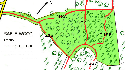
 Five footpaths traverse Sable Wood. The only named path is FP218B, Marjorie’s Path, named after Marjorie A Kuck, a resident of the Lower Bourne who worked to establish footpaths in the area.
Formal responsibility for maintenance of the surface of the footpaths rests with Surrey County Council. Since at least 2011 Surrey CC has carried out no maintenance apart from the replacement of rotten signposts. Repair of the heavily rain-eroded FP218 in 2014, the construction of steps at the junction of FP241 and FP237 in 2017, and the further construction of steps at the lower end of FP241 in 2018 were carried out by the owners and the Bourne Conservation Group. See under ‘Footpath repair‘ for more details.
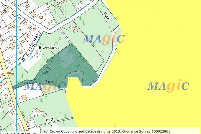 In contrast to the adjacent Forestry Commission’s Bourne Wood, there is no right of access to Sable Wood away from the designated public footpaths. In the accompanying map, right of access under the Countryside and Rights of Way Act 2000 applies in FC’s Bourne Wood (the area shaded yellow) , but not in Sable Wood (shaded dark green).
Source: DEFRA MAGIC website.